When you look up at the clouds, what do you see? A blob, a wisp, perhaps an elephant-shaped clump. It’s fun to get creative with the descriptions, but scientists have a formal classification system that can be useful to the everyday cloud watcher, too. We’ve made a field guide to types of clouds, so next time you’re enjoying a day outside, you can put your newfound knowledge of the skies to work.
What’s in clouds and their names?
Clouds are made up of droplets of water or tiny ice crystals floating in the planet’s atmosphere. They hold clues about the weather—like if it’s going to rain, snow, or worse—and the interesting physical and chemical cycles churning through the air.
“They are such an amazing feature of Earth that are simply fun to look at and study,” says Vanessa Maciel, an atmospheric scientist at the University of California, Los Angeles. Clouds are shaped by the many changing characteristics of the atmosphere: temperature, moisture, winds, and more.
[Related: Make your own weather station with recycled materials]
Just like animal species, climate scientists have a system for naming clouds with genera, plus smaller subdivisions of species and varieties. These designations are based on their shape, appearance, and how high they are in the atmosphere. Each genus of clouds can be described as one of four main shapes, first categorized in 1803: cirro-form, cumulo-form, strato-form, and nimbo-form. Cirro-type clouds are the thin wisps; cumulo-type clouds are huge and fluffy; strato-type clouds are wide and flat layers; and nimbo-type clouds are the quintessential gray rain clouds.
The astonishing diversity of clouds might seem overwhelming to a beginning cloud-gazer, but Maciel has advice on where to start. “A great way to narrow down the type of cloud you are seeing is to first try to estimate whether it is in the lower, middle, or high atmosphere,” she says.
High clouds
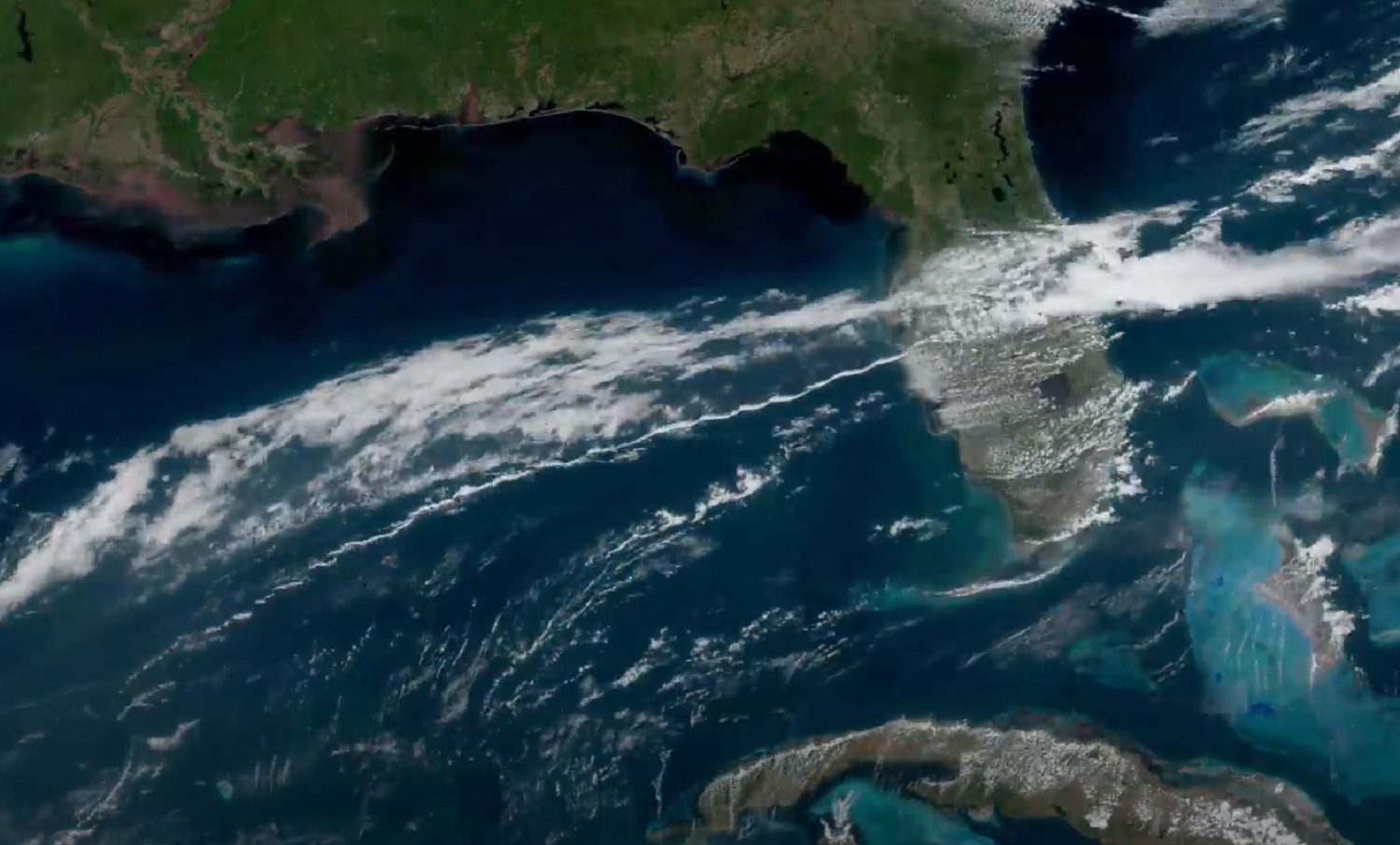
The highest clouds are the wispiest: cirrus, cirrocumulus, and cirrostratus. They generally form above 20,000 feet, and typically indicate a coming change in the winds or weather. In certain regions of the tropics, they can even indicate that hurricanes are on the way. Generally, the air gets colder higher up in Earth’s atmosphere, so cirrus and friends are made up of ice crystals that are stretched and spread by the winds, giving them their thin, strand-like shapes.
Cirrus are the thinnest wisps, whereas cirrocumulus appear more like a thin, rippled white sheet. Cirrostratus are a more homogenous sheer veil. If you see a bright halo forming around the sun, that might be the cirrostratus. When cirrus clouds stack together like ridges, almost like a rack of ribs, the variety is called vertebratus.
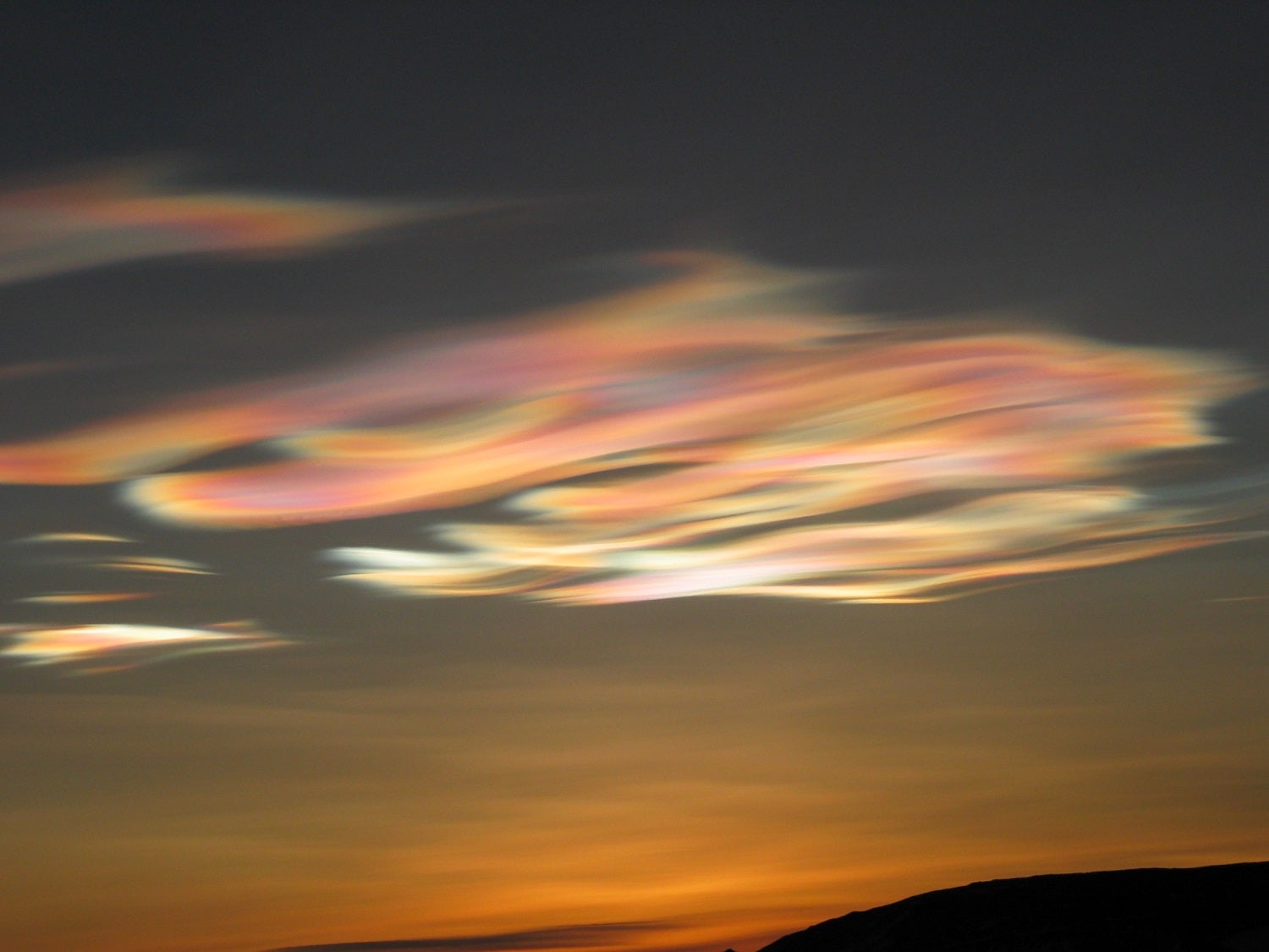
Maciel’s favorite cloud looks a bit like a cirrus cloud, but is actually something quite different. Nacreous clouds, also known as mother-of-pearl or ice polar stratospheric clouds, are made of very cold ice. When the sun goes down they catch the light and reflect brilliant colors. “These colors occur only during sunrise and sunset, and are created by the interaction between sunlight and the cloud’s ice crystals, which are smaller than that of a standard ice cloud,” says Maciel. “They are also pretty rare as they only occur at high atmospheric altitudes and high latitudes.” Your best bet of seeing them is near the planet’s poles.

Mid-level clouds
In the middle of the atmosphere, we start to see more clumps: altostratus and altocumulus. They can be found 6,500 to 20,000 feet up, and tell very different tales when it comes to weather—altocumulus often mean you’ve got a pleasant day ahead, but altostratus indicate a long bout of rain or snow.
Altostratus appear as large, flat sheets that aren’t quite thick enough to block out the sun entirely. Altocumulus, on the other hand, look like a horde of little cotton balls scattered in the sky. You’ve likely seen a few different species and varieties of altostratus and altocumulus before, particularly cavum. This variety is a continuous sheet of cloud with a big chunk missing. Stratiformis is another common species of altocumulus, where high clouds appear like a patchy, ridged sheet. Similarly, if there are layers of cloud that cover the sun entirely, they may be a variety known as opacus.
Low clouds
Many kinds of clouds start close to the ground—6,500 feet or below—and extend high into the atmosphere. These clouds are called nimbostratus, stratus, stratocumulus, cumulus, and cumulonimbus. These clouds are made up of water droplets from the surrounding warm air, creating their quintessential fluffy look.
Nimbostratus are the gray gloomy clouds that indicate rain. Stratus clouds also create gloomy days as they cover the sky in a low sheet of dingy white. Stratocumulus are somewhat similar to altocumulus, but they have a darker shadow and don’t appear quite as bright white as their higher altitude counterparts.
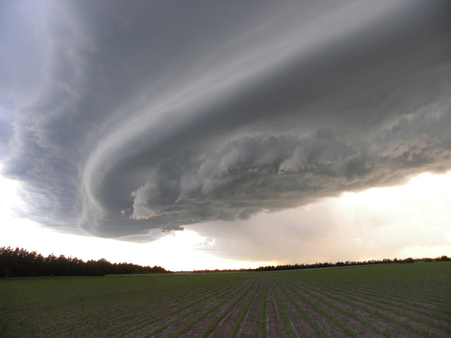
Cumulus and cumulonimbus clouds are the behemoths of the bunch. Cumulus are huge white clouds reaching high up into the sky—the classic cotton balls. Cumulonimbus, on the other hand, are imposing and a bit foreboding, with a high, flat top and a promise of rain storms.
[Related on PopSci+: Cloudy with a chance of cooling the planet]
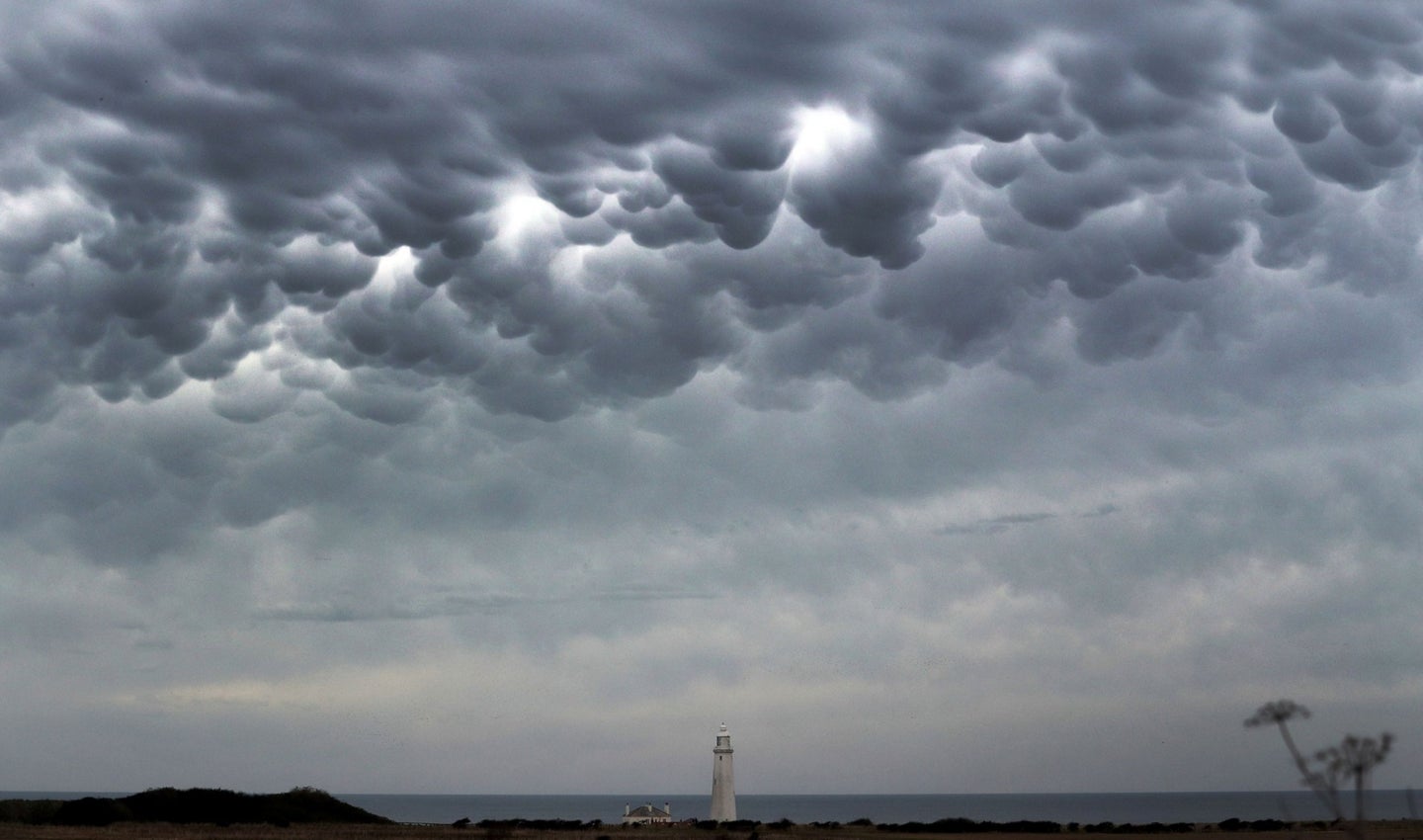
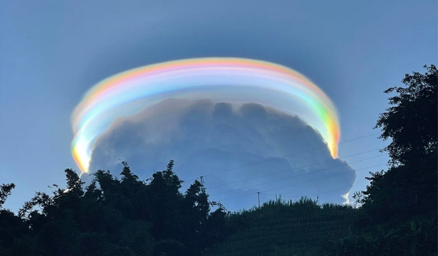
Low clouds come with some of the oddest and most interesting varieties and features. This is where tubes or vortexes appear from clouds, called tuba. They can also show—for a brief moment, anyway—a feature that looks like a set of perfect crashing waves, known as fluctus. Although the fluctus pattern looks almost too good to be true, it’s a somewhat common consequence of the physics of fluid motions. Stratocumulus clouds can also put on a cow costume: That is, they can grow little nubs on their undersides that almost look like udders, known as mamma. Cumulus clouds can even put on a hat, an accessory cloud called pileus that pops up at the top of one of these huge cloud formations.
What clouds to look for now
This summer, you can expect all the fair weather clouds, plus some of the weirder ones that pop up with summer storms like pileus. “Summer usually has clear skies, unlike the overcasts typical of winter,” adds Maciel. “But as summer also has a lot of convection due to the warm surface temperature, you can expect to see cumulus clouds, which are your iconic fluffy and bright white clouds.”
Clouds are just as complex as their classifications, and they’re changing not just with the seasons, but also with the climate. As Earth’s temperature warms, the varieties we see might change, too. “In spite of their ubiquity, there is still a lot about clouds that we don’t know,” says Maciel. For now, though, see how many you can spot—and enjoy the beautiful views provided by our planet’s magnificent atmosphere.
The post A scientific guide to clouds, even the ones that look like udders appeared first on Popular Science.
Articles may contain affiliate links which enable us to share in the revenue of any purchases made.
from | Popular Science https://ift.tt/28sAdr5


0 Comments